Every search and imagery view in MetroMap contributes to data usage. A data limit establishes an annual cap on the amount of imagery a team can browse and download, helping organisations with multiple users plan and monitor usage across their teams. Pro and Team plans have no fixed data cap, with usage governed by the Fair Use Policy. Enterprise customers can select an annual limit of 4 to 99 GB or opt for unlimited usage.
| Fixed-price plans (1 or up to 5 users) | Enterprise plan (any number of users) | |
|---|---|---|
| Data limit | Unlimited, under a fair use policy | Chosen by the buyer: 4 to 99 GB a year, or unlimited |
| Who sees usage | Single-user plan: no usage view. Plan for up to 5 users: the admin sees the group's use; other members do not. | Admin users see the whole team's use; other members do not |
| Ways to connect | Web app only | Web app, plus API, WMS and WMTS keys and an ArcGIS service as options |
| Price (GST included) | $2,640 a year for 1 user, $6,999 a year for up to 5 | Quoted to suit needs and budget |
| Billing | 12-month term, paid monthly or yearly | Yearly term, billed monthly, quarterly, twice a year or yearly; longer terms by agreement |
Under an Enterprise plan, only admin users can view team data usage. Other team members and Pro users do not have access to this information. Where an annual data cap applies, usage includes both browsing and downloads across the entire team, and administrators can assign individual user limits. This helps organisations monitor consumption before users reach their allocated limits.
For teams of five or fewer users working within the web application, the Team or Pro plan offers a simpler option. Both plans include unlimited data at a fixed price, eliminating the need to monitor usage against a set cap.
API usage tracking measures the volume of data retrieved by a connected system through an API and the frequency of its requests. MetroMap Enterprise plans can include API, WMS and WMTS keys, while API access requires an Enterprise or Partner plan and an API key. The MetroMap Fair Use Policy identifies API call volume, the number of concurrent requests and request frequency as factors in determining excessive usage.
An API connects two software applications, allowing one to request data from the other. Through MetroMap’s API, a GIS or asset management system can pull in imagery automatically, without anyone clicking through the web app. Because those requests run in the background, data use can add up quickly.
Staff can use the MetroMap web app, or the API can feed imagery straight into the businesses own systems.
Every time a system asks for imagery, it sends a request. MetroMap’s API supports Web Map Service (WMS), a standard set by the Open Geospatial Consortium. The WMS standard states that "a WMS request defines the geographic layer(s) and area of interest". In plain terms, each request names a layer and an area.
Imagery loaded through the MetroMap API counts toward the same data usage as the web app, and API access stops when a user reaches their limit.
MetroMap admin users can monitor team data usage through the Usage Analyze tab in the Admin Panel and manage individual user limits through their settings page. Pro users and non-admin members of Team and Enterprise plans cannot access usage information.
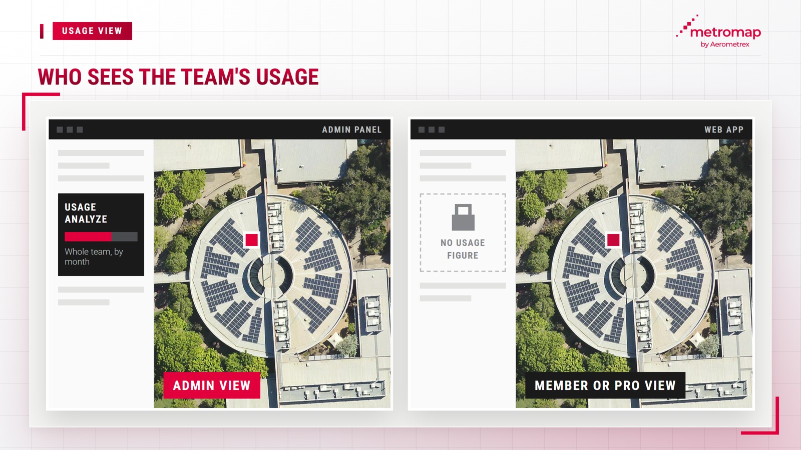
Who can see usage depends on the plan and on whether you hold the admin role:
The Usage Analyze tab displays monthly data consumption, request counts and active user numbers through graphs or CSV exports. Users with assigned data limits receive email notifications when their usage reaches 50%, 85% and 100% of their allocated limit.
MetroMap's data usage types are the ways you can get its imagery: the web app, the API, WMS and WMTS feeds, and an ArcGIS service. Every MetroMap plan includes the web app, while the API, the WMS and WMTS keys and MetroMap Image Dedicated for ArcGIS are Enterprise options.
WMS and WMTS are open standards established by the Open Geospatial Consortium. WMS delivers a map image in response to each request, while WMTS is designed to "serve digital maps using predefined image tiles". The OGC's WMTS standard page describes WMTS as a complementary standard to the existing WMS framework.
| Usage type | What it does | MetroMap plans |
|---|---|---|
| Web app | View, compare, measure and download images | Pro, Team, Enterprise |
| API | Pulls imagery into the customer's own software | Enterprise (optional) |
| WMS and WMTS | Streams imagery as a live layer in GIS or CAD tools | Enterprise (optional) |
| MetroMap Image Dedicated for ArcGIS | Streams imagery into Esri's ArcGIS products | Enterprise (optional) |
MetroMap Image Dedicated for ArcGIS is designed for integration with Esri tools, streaming the national Australia Latest imagery layer directly into Esri's software suites.
Data allowances vary by MetroMap plan. Pro and Team plans include unlimited data usage subject to the Fair Use Policy, while Enterprise plans offer customisable annual data limits based on organisational requirements and budgets, ranging from 4 to 99 GB or unlimited usage.
MetroMap calculates data usage based on the number of tiles displayed on screen, which are the small square images that form the map. Screen size, zoom level, panning, downloads, the Clip It tool, API tile requests and cache refreshes all contribute to data consumption. However, switching the base layer from street view to satellite does not count towards usage.
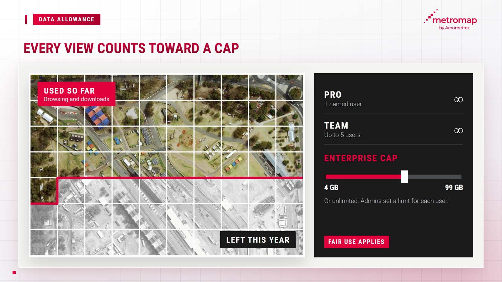
A MetroMap Pro subscription costs $2,640 per year, including GST, for one named user, while the Team plan costs $6,999 per year, including GST, for up to five named users, with both prices based on annual payment.
Enterprise plans are also available, with pricing provided upon request from MetroMap. The MetroMap plans page provides a detailed comparison of the features included in the Pro, Team and Enterprise plans.
Enterprise plans offer greater flexibility than Pro and Team plans in contract terms, billing arrangements and data allowances:
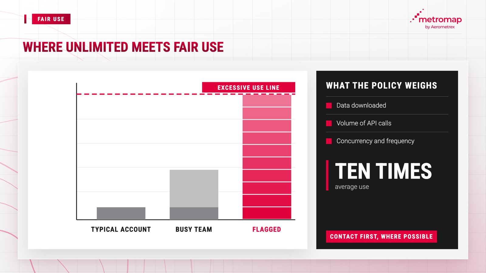
Unlimited data usage under Pro and Team plans remains subject to the MetroMap Fair Use Policy, which applies to all users. The policy defines excessive usage as "unreasonably disproportionate" compared with other users, citing usage "ten times the average usage of all other customers" as an example. Assessment factors include the number of automated feeds used and the volume of data downloaded.
Pro and Team plans have no fixed GB limit, although usage remains subject to the Fair Use Policy. Under Enterprise plans, administrators assign individual user limits, and MetroMap restricts access when a user exceeds their allocation until an administrator increases it. If additional data is required, an administrator can negotiate a higher allowance with their MetroMap representative.
If a customer’s usage affects service availability for other customers, Aerometrex may “temporarily suspend, restrict or limit” access. The policy further states that Aerometrex “will try and contact you prior to doing so, or as soon as practicable afterwards”.
The following questions may help determine an appropriate Enterprise data limit:
No. Pro and Team come with an unlimited data allowance under the Fair Use Policy. MetroMap's Subscription Terms limit a free trial to 7 days and 250 MB of data, unless MetroMap agrees another limit, and Enterprise plans come with a customisable limit from 4 to 99 GB a year or unlimited.
No. In MetroMap, only admin users can see their team's usage. Pro users and non-admin members of Enterprise and Team plans cannot.
No. API, WMS and WMTS keys are Enterprise features, and Pro and Team work through the MetroMap web app.
Both are open standards for sending map images to other software. WMS sends an image for each request, while WMTS sends ready-made tiles.
Yes. On MetroMap Enterprise plans, the yearly data figure covers browsing as well as imagery downloads, and admins can set a limit for each user.
MetroMap Enterprise plans run on a yearly term, and multi-year contracts can be negotiated. Billing within the 12-month term can be monthly, quarterly, twice a year or yearly.
View the world from our eyes ! Here we share some exciting images from across MetroMap