


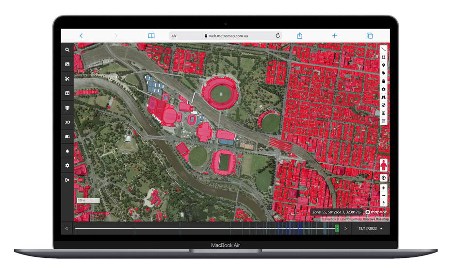
Say goodbye to costly site visits and enjoy the convenience and efficiency of MetroMap.
This powerful tool empowers you and your company with instant access to high-resolution aerial imagery of both metro and regional areas across Australia, allowing you to access, analyse and act with ease.


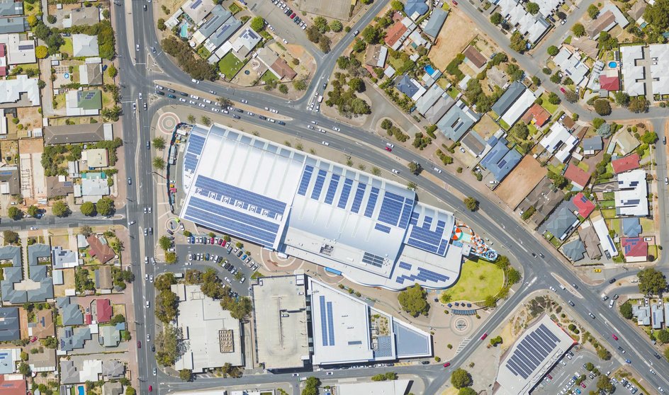
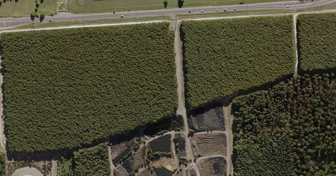
MetroMap aerial imagery offers higher resolution and better accuracy than satellite imagery, allowing for precise measurements and a greater understanding of your areas of interest.
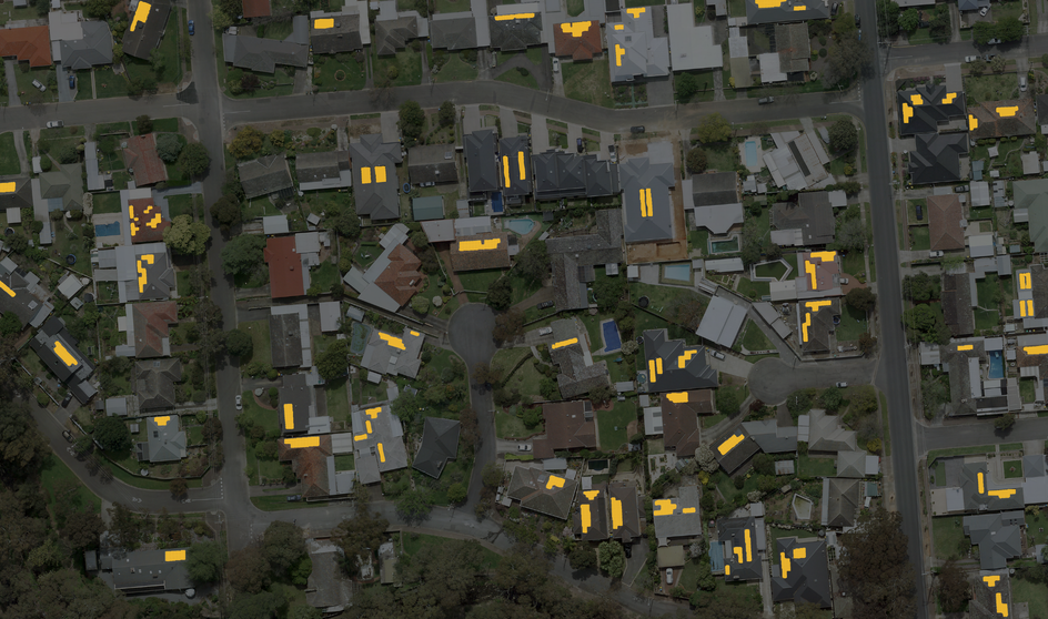
With MetroMap Insights, you can leverage the power of our aerial imagery, artificial intelligence, and cloud computing to obtain actionable insights, reduce hours of manual analysis, for efficient decision-making and solving key business questions.
MetroMap Image Dedicated for ArcGIS is an Esri-compliant service that enables your organisation to access the full value of MetroMap's data. It empowers your teams to harness the full potential of our imagery while optimising performance, scalability, and cost-effectiveness.
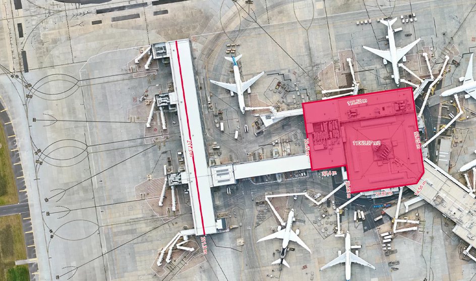
MetroMap allows you to accurately calculate distances and areas and save the information via layers or export them to a third-party GIS software using a .KML file.
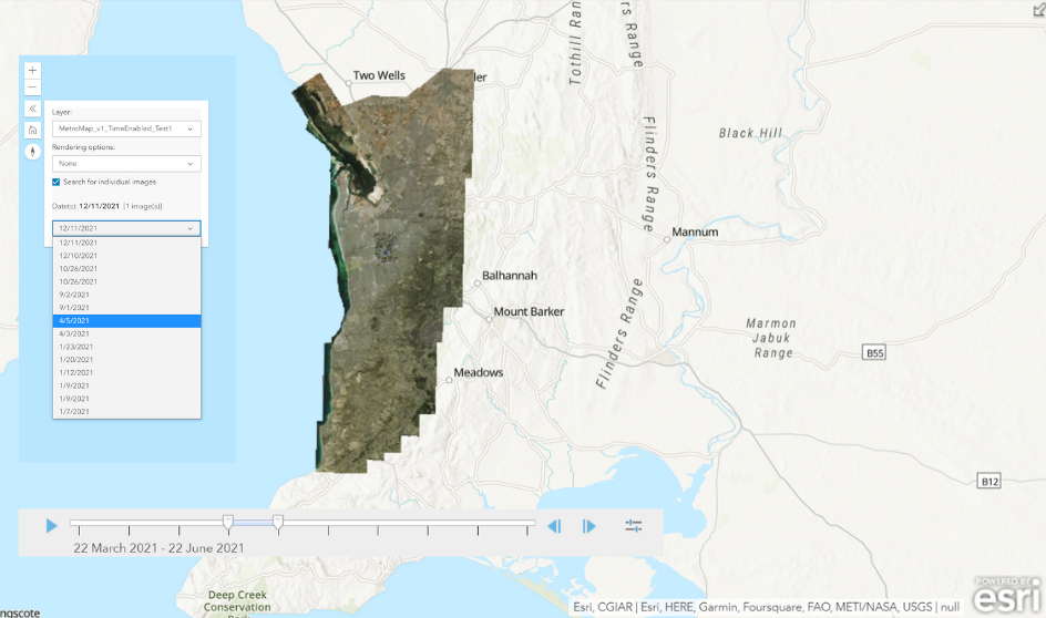
Go back 20 years or more with MetroMap’s high-resolution, accurate aerial imagery. Use the swipe tool to view two datasets from different dates, side by side. Giving you the ability to monitor change, view assets and plan for the future.


Find the details that matter to your team.
| Feature | Pro | Team | Enterprise |
|---|---|---|---|
| User access | |||
| Named users | 1 | Up to 5 | Custom |
| Unlimited data allowance1 | Custom | ||
| Web app access | |||
| View & compare imagery | |||
| Australia-wide high-res aerial imagery2 | |||
| 4-band near-infrared imagery layers | |||
| Swipe tool: compare historical and current imagery | |||
| Google Street View & base map layers3 | |||
| Oblique imagery: view buildings at 45° angles | |||
| Search & navigation | |||
| Search by coordinates, address or place names | |||
| Elevation & terrain | |||
| Height & elevation data: measure buildings, trees and terrain | |||
| Dynamic contours with hill shade digital elevation model | |||
| Measure, draw & manage layers | |||
| Measurement, drawing & labelling tools | |||
| Save, export & screenshot layer features | |||
| Import user layers | |||
| High-res image downloads | |||
| Download in multiple file types & projections | |||
| Geoscape feature layers4 | |||
| Property boundary (Cadastre) & details | Optional | ||
| Building footprint insights | Add-on | Add-on | |
| API & integrations | |||
| WMS/WMTS Access | Optional | ||
| MetroMap Image Dedicated for ArcGIS | Optional | ||
| Training & support | |||
| Online docs & in-app tool tips | |||
| Customer support team | |||
| Dedicated account manager | |||
| Onboarding & training webinars | |||
*Compared to monthly payments.
1. Fair usage policy applicable.
2. Refer to coverage map for details of extent and frequency of capture.
3. StreetView, satellite and road map layers are sourced from third parties.
4. Property boundary (Cadastre), building footprints and associated feature information is sourced from partner Geoscape.
5. Plan features are subject to change.
MetroMap offers partners the opportunity to build their own applications around our base aerial imagery and derived datasets. As a partner, we want you to be trusted solution providers for your customers - professional and successful. With our cutting-edge technology, and as a part of our Partner Program, we make sure you have the best possible tools to achieve that. You can bundle your services with MetroMap solutions to deliver complete geospatial insights to your customers. Learn more about Partner opportunities here.